Ground truth: When the Earth moves, AI can spot it
 Summary
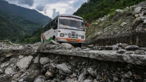
Landslides and avalanches cause significant annual loss of life and property damage, prompting the need for better prediction methods. Artificial intelligence, particularly machine learning applied to vast amounts of satellite radar imagery (like that from Sentinel-1), can detect subtle ground movements invisible to the naked eye, often years before a collapse. Mathematician Antoinette Tordesillas is using this AI approach in Nepal to map unstable areas, such as beneath the village of Kimtang, to inform residents and plan mitigation. In the UK, researchers are analyzing 300,000 slopes, finding thousands actively moving, which could impact infrastructure. AI significantly speeds up data analysis that would take humans months or years. Furthermore, AI is being used post-disaster, as seen when the British Geological Survey mapped over 4,000 landslides in Sumatra quickly. In other applications, AI is helping to refine risk assessments, potentially allowing construction in areas previously deemed too dangerous, as demonstrated in Medellín, Colombia. While AI shows immense promise, experts stress the need for a human in the loop for critical decisions, as systems can still produce false positives, such as in avalanche detection trials in Austria.
(Source:Bbc)